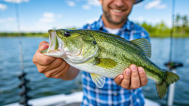

Finding bass on Lake Guntersville is less about chasing famous spots and more about understanding why fish gather in certain areas. Water depth, grass quality, bait movement, current, and bottom type can turn one stretch into a feeding zone while nearby water stays quiet. Guidance from a knowledgeable Guntersville fishing guide helps anglers connect those details and spend more of the day around active fish.
Checking Main-Lake Ledges Where Bass Stack Up in Deeper Water
Summer and post-spawn bass often use main-lake ledges because those breaks give them quick access to different depths. Experienced Guntersville AL fishing guides look for bends, drops, small rises, and places where current sweeps food across the structure rather than treating every ledge alike. Sonar can show fish and bait, but those marks become more useful when they line up with a channel edge, hard spot, or change in bottom shape. Proper boat position matters too, since a cast crossing the break can keep a lure in the strike zone longer than one passing through empty water.
Finding Healthy Grass Lines That Hold Baitfish and Feeding Bass
Healthy grass can hold shade, insects, small forage, and ambush cover, giving bass several reasons to stay close. Skilled fishing guides Lake Guntersville visitors hire often focus on outside edges, points in the grass, holes, isolated clumps, and places where vegetation meets deeper water. Rather than covering an entire weed bed, they search for small differences that gather bait or create an easy feeding lane.
Grass condition can change from one pocket to the next even when the surface looks similar. Strong green vegetation usually offers better habitat than dying growth, while wind may push bait onto one edge and leave another side quiet. Reading those differences lets a Guntersville bass guide reduce a broad grass flat to a handful of better targets.
Targeting Creek Channel Bends Near Shallow Feeding Areas
Creek channel bends give bass a natural travel route between deeper holding water and nearby feeding areas. During changes in light, temperature, or current, fish can move toward flats and cover, then slip back toward the channel without traveling far. Local guides pay close attention to bends that swing near grass, points, docks, or shallow pockets because those combinations provide several feeding options in a compact area. These places can stay useful through more than one season even though the productive depth may shift.
Watching for Points Where Deep Water Meets Heavy Cover
Points become more valuable when they connect different types of habitat. One side may fall quickly into deeper water while the top supports grass, stumps, rock, or other cover where bass can feed. A Guntersville fishing guide service can use that layout to test several depths without making a long run across the lake.
Wind can improve a point by pushing bait and surface current toward it. Current from power generation may also help if it carries forage past the break and gives bass an efficient place to wait. Watching how moving water meets cover explains why one point produces again and again while a similar-looking one stays empty.
Locating Hard Bottom Areas Mixed With Grass or Shell Beds
Hard bottom often gives bass a cleaner feeding area than soft silt, especially where rock, gravel, or shell lies beside vegetation. Subtle transitions may hold crayfish, mussels, and baitfish while giving jigs and worms a distinct surface to work across. Mapping, sonar, and the feel of a lure dragging across the bottom can help a Guntersville fishing guide locate these smaller zones. Once a useful patch appears, accurate casts matter because the best section may be only a small part of the surrounding flat or ledge.
Following Baitfish Movement to Narrow Down Active Bass Zones
Baitfish can reveal more than a saved waypoint because bass often move with their food. Shad may rise early, drop deeper under bright sun, collect near current, or drift toward windblown cover, and bass commonly follow those shifts. Guides who know Lake Guntersville watch for surface flickers, bird activity, sonar marks, and repeated schools at similar depths to judge whether an area still has feeding potential.
Chasing one isolated school of shad is not always productive. Better patterns develop when forage keeps appearing beside useful structure such as a grass edge, ledge, channel bend, or point. Combined with local experience, those clues help Guntersville AL fishing guides identify places where bass can trap bait instead of simply following scattered fish across open water.
Using Seasonal Patterns to Choose the Right Creeks, Flats, and Ledges
Seasonal movement helps shrink Lake Guntersville into a more manageable search area. Spring often brings attention to spawning pockets and transition routes, summer increases the value of deeper grass and offshore structure, fall can become heavily tied to shad movement, and winter may concentrate fish around stable depth and cover. Conditions on the actual day still matter, since a warm afternoon, changing water level, fresh current, or strong wind can move fish away from yesterday’s pattern. Knowledge from a local Guntersville bass guide helps anglers compare those seasonal expectations with what the lake is showing in real time. Anglers searching for fishing guides Lake Guntersville can also use a guided trip to learn why one creek, flat, grass line, or ledge becomes productive while another does not. For anglers who want that type of local instruction, Donald Johnson Fishing is one option for a Guntersville guide service focused on helping guests locate bass by reading cover, structure, bait, depth, and seasonal movement instead of depending on a list of fixed spots.